Proposed Projects to Improve Groundwater Sustainability
West Linden Project
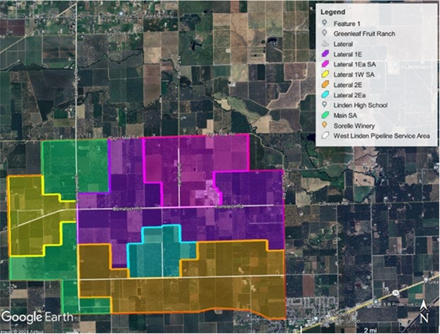
The District is proposing to work with East Bay Utility District (EBMUD) to utilize EBMUD’s Mokelumne Aqueduct for a pressurized irrigation system west of Linden. The conceptual design includes pressurized sand filtration, pipelines, pumping station, ASR Wells, Dry Wells, Recharge Ponds, Hydropower, and Ag turnouts. The Project is proposed between Jack Tone, Baker, Duncan and Eight Mile Roads. The project would provide surface water to approximately 5,674 acres of farmland. Upon final build out this project would provide approximately 15,880 AFY of in-lieu recharge through surface water delivery for agriculture demand, and up to 11,603 AFY of direct recharge through ASR or dry wells. Partnering with EBMUD would allow for more direct recharge to the subbasin. EBMUD would benefit by utilizing the area for groundwater banking.

Houston, DeMartini and Clements Pipelines
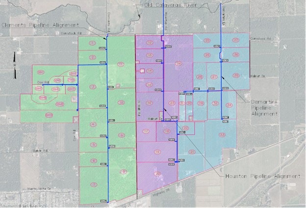
The District is proposing three gravity-fed pipelines on the Old Calaveras River upstream of Clements Road that would provide surface water to approximately 1,200 acres of farmland. These pipelines would provide surface water in lieu of groundwater to 37 grower parcels. This would save approximately 3,360 AFY of groundwater stored in the subbasin. Additionally, these pipelines would provide approximately 8,741 AFY of direct recharge. The gravity pipelines would run from the Old Calaveras River south to Highway 26, bordering 37 parcels with a total of 29 turnouts. The project includes pipeline easements, permitting, pipeline construction, dry wells, and aquifer storage recovery wells. There is also the potential to partner with Santa Clara Valley Water District (Valley Water) for groundwater banking through these three projects.

Mosher Pressurized Pipeline
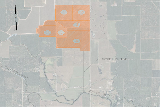
Another proposed project is to construct a pump and pipeline for surface water access to approximately 178.91 acres and 6 grower parcels north of the Old Calaveras River and Mosher Slough west of Clements Road. If all six of these parcels converted to surface water from this pipeline there would be an in-lieu recharge of approximately 500 AF. This pipeline could also provide approximately 1,583 AF of direct recharge through Flood-MAR, ASR wells, and dry wells. There is also the potential to partner with Valley Water for groundwater banking through this project.

